The tropics are churning again
We are a week out from the official start of the 2021 Atlantic hurricane season. Hurricane season runs from June 1st through November 31st. Just last week the National Oceanic and Atmospheric Administration (NOAA) released its hurricane outlook.
Guess what, NOAA is forecasting another above-average season. Yep, the tropics will be active once again. However, they’re also saying it won’t be as active as last year’s record-breaking season. Whew...

An active hurricane season is not new. Every season since 2016 has been above-average for the number of named storms and hurricanes. Going deeper, NOAA is also using a new set of climate normals to describe the average number of named storms, hurricanes, and major hurricanes. These new averages reflect the increased hurricane and tropical storm activity over the last 30 years.
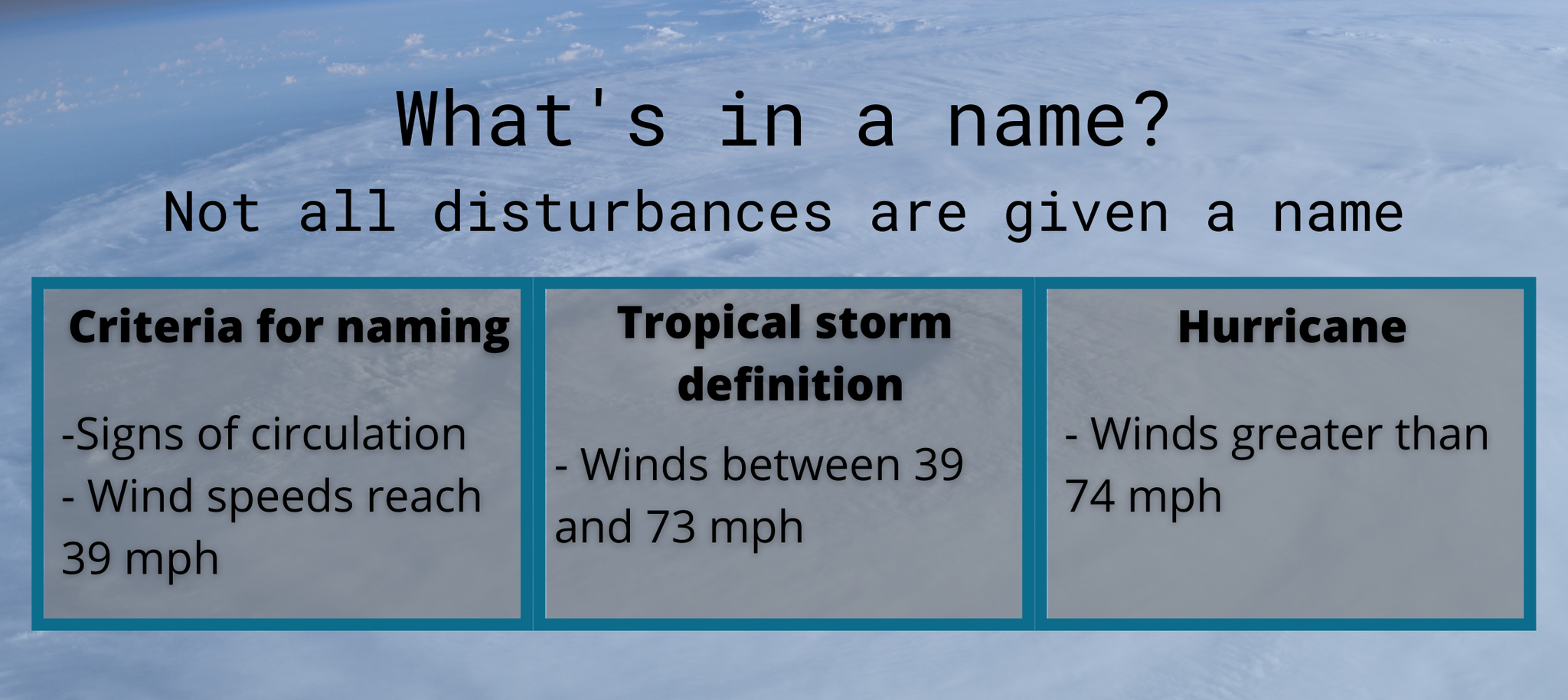
In this post, I'll break down the previous climate records NOAA used when describing hurricane season normals, and give a brief overview of this upcoming hurricane season, and compare it to last year.
New Atlantic Averages
Climate normals are the three-decade averages of climatological variables. These variables include anything from temperatures, rainfall, tornadoes, hurricanes, etc. Climate normals act as a baseline for comparing forecasts, predictions, outlooks, etc. for a given location. Every ten years the climate normals are re-calculated to reflect the most recent data.
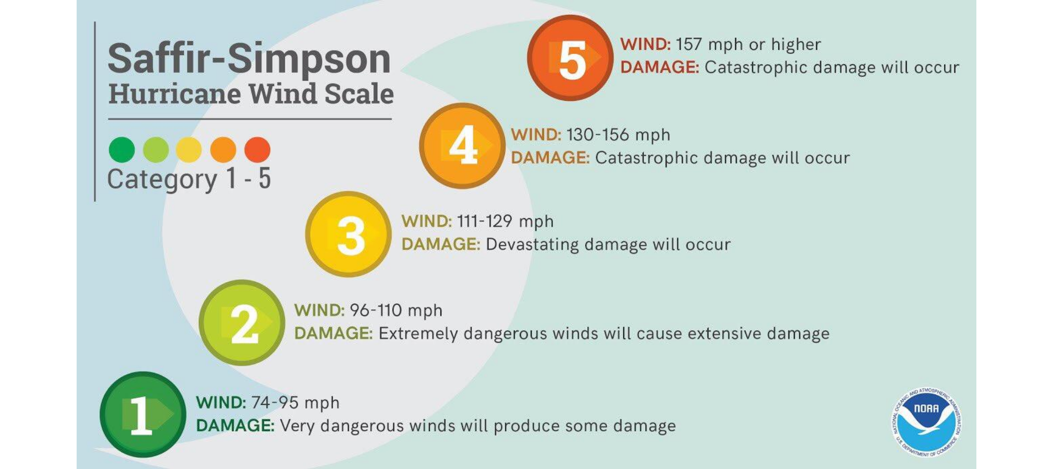
The 2020 hurricane season used climate normals from 1981 to 2010. However, there's been an increase in hurricane and tropical activity in the past 30 years. Beginning this year, we are using a new set of climate normals that reflects the increased activity. The new set of averages uses data from 1991 to 2020. The increase in activity in part is due to warmer global temperatures and ocean waters.
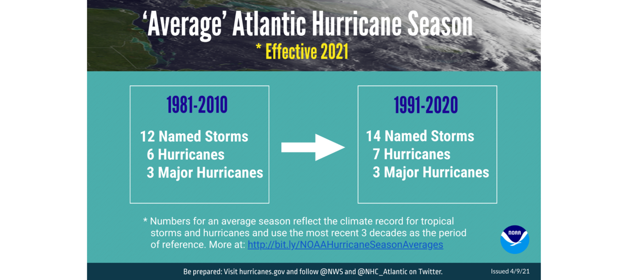
Here are the changes: The previous Atlantic storm averages described an average season as 12 named storms, six hurricanes, and three major hurricanes. The new normal is now 14 named storms and seven hurricanes. Thankfully, the average number of major hurricanes (Cat. 3, 4, and 5) has stayed the same.
What about the Eastern Pacific and Central Pacific? Those averages have not changed with the new 1991 - 2020 data. The average activity in the Eastern Pacific is 15 named storms, eight hurricanes, and four major hurricanes. While in the Central Pacific, the average is four named storms, three hurricanes, and two major hurricanes.
Refresher - what happened in 2020?
When NOAA forecasters released their 2020 hurricane season outlook, they called for a 60% of above-average activity. They predicted 13 to 19 named storms, of which six to ten could become hurricanes, with three to six major hurricanes.
In August, NOAA announced an update to their hurricane season predictions, saying the season could see as many as 25 named storms. By September, we had already exhausted the 2020 list of hurricane names and moved to the backup list for only the second time in history. The backup list used the Greek alphabet to name storms.
The season concluded with 30 named storms. 13 of those became hurricanes, and six reached major hurricane strength, breaking the previous record set in 2005 for the most named storms. It was also only the second time in history forecasters used the Greek alphabet storm names, the first time this occurred was also in 2005.
2021 is going to be above-average, but not as above-above-average as 2020
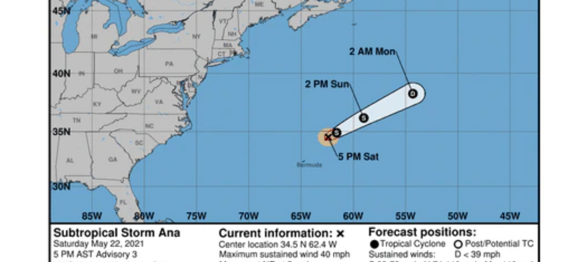
Hurricane season has already kicked off this year with our first storm, Tropical Storm Ana, forming near Bermuda. Thankfully the storm was no threat to land and dissipated Monday.
NOAA forecasters are calling for a 60% chance of increased storm activity in the Atlantic. NOAA Predicts a range of 13 to 20 named storms. Six to ten of the named storms could become hurricanes, with three to five reaching major hurricane strength. When NOAA releases these ranges, there is a 70% confidence that the season’s storm activity will fall within the range.
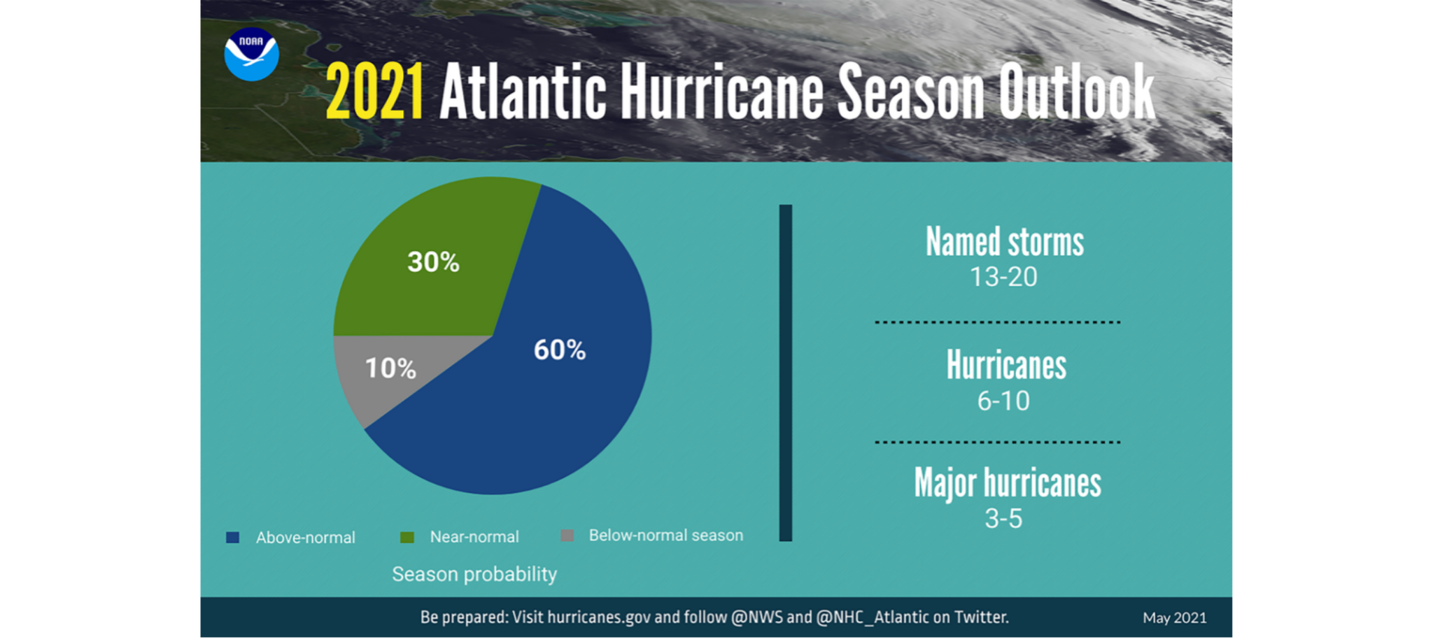
So we know this season has the potential to be active, but not as much as last year. Thank goodness... We're in the neutral phase of the El Nino Southern Oscillation (ENSO). ENSO describes the atmospheric and oceanic coupling and is an important climate phenomenon because it influences global temperatures and storm activity. ENSO phases can be forecasted months in advance by looking at water temperatures in the Central Pacific. As the water warms and cools, it influences rain in the tropics and weather in the United States.
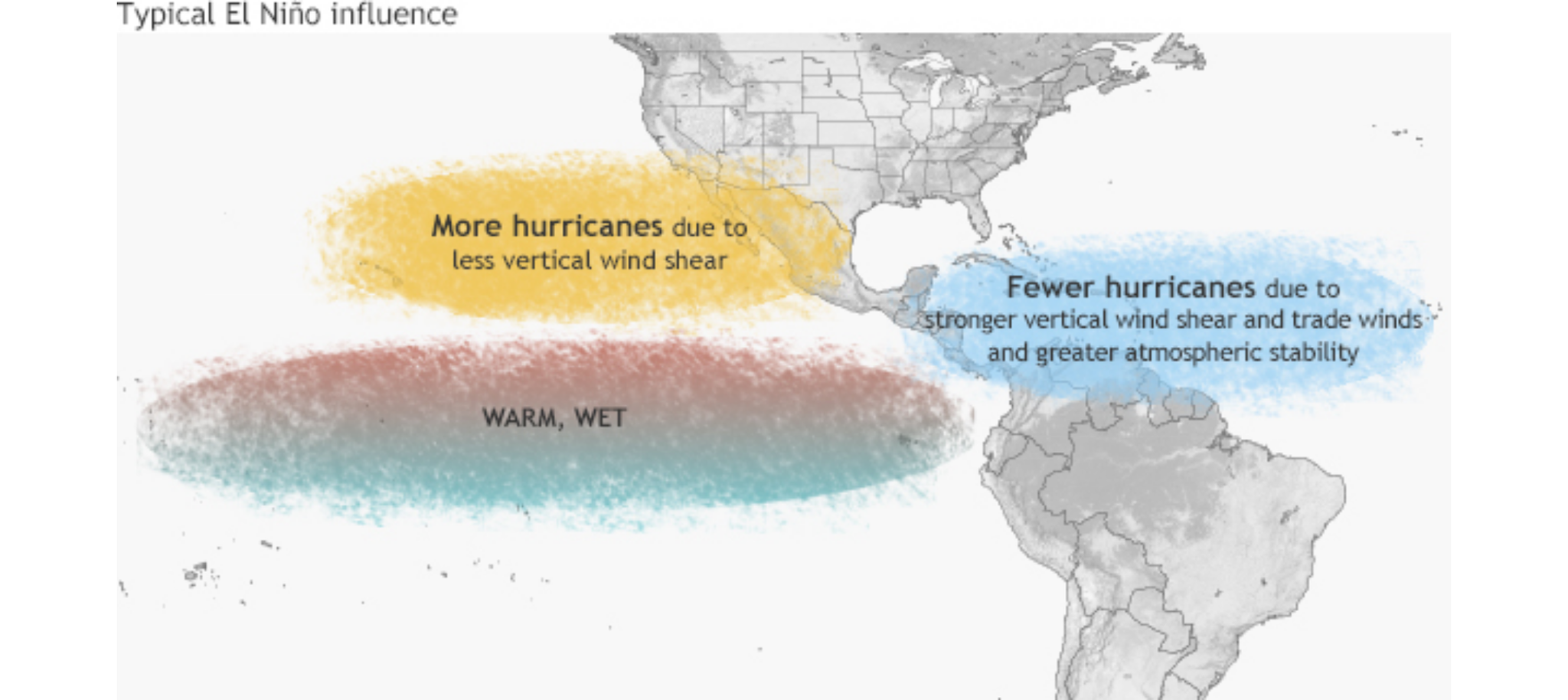
El Nino is the warm phase of the ENSO pattern, with warm ocean waters found off the west coast of South America. This phase is unfavorable for hurricane activity in the Atlantic because it produces more wind shear which tears apart hurricanes.
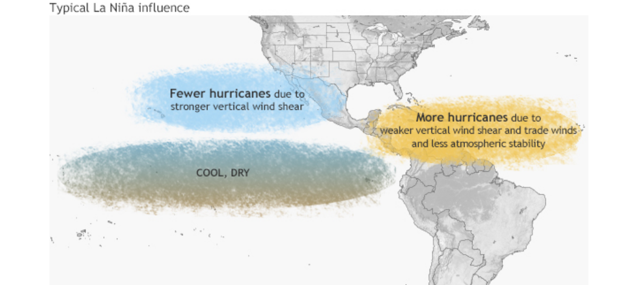
La Nina is the cold phase of the ENSO pattern with cooler ocean water temperatures found off the west coast of South America. This is more favorable because of the decreased wind shear in the Caribbean and Atlantic, increasing the potential for hurricanes. Last year was a great example of more hurricanes and tropical storms during a La Nina year.
During the ENSO Neutral phase, the central Pacific ocean temperatures are closer to average. However, this phase can have similarities to an El Nino or La Nina pattern, but the atmosphere may not be playing along with the coupling (and vice versa).
Right now, the ENSO state is neutral, but NOAA is predicting the return of La Nina later in the hurricane season, which could increase the storm activity.
Other changes to the hurricane season
Given the increased number of named storms forming before the official start of hurricane season, NOAA is considering changing the hurricane season dates. For seven consecutive years, tropical storms and hurricanes have formed earlier, prompting NOAA to consider moving up the season start date to May 15th.
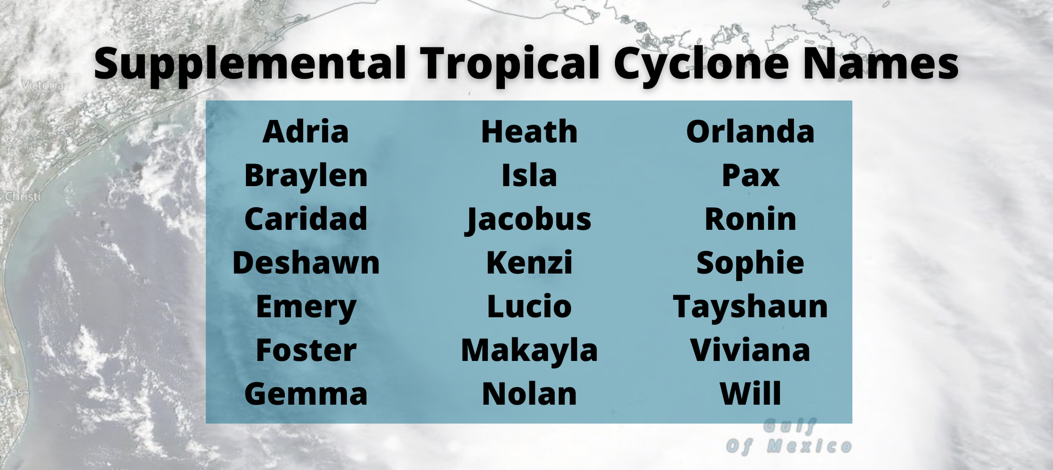
Another major change is we are no longer using the Greek alphabet to name storms. Instead, NOAA has a supplemental list of names. Last year’s use of the Greek alphabet led to confusion in communication and issues when translating into other languages. Additionally, two of the Greek-named storms, Eta and Iota, are now retired because of the catastrophic damage they caused. Laura was also retired, but that name was on the original list.
The new supplemental list includes 21 names and is only updated if a name is retired.
Just remember, it only takes one storm to cause catastrophic damage and to forever change lives. Be prepared, no matter the outlook.

0 Comments Add a Comment?