Look at all those pretty colors
Get ready to bust out your radar apps! With spring comes an increased risk for thunderstorms. So don't be caught off guard. Radar is not just pretty colors, it means something. With some practice, you can interpret radars like a pro.
Over the next few weeks, I'll explain how radars work and teach you some important interpretation skills. Feel free to use these posts as a guide. When storms are near, get ready to show off to your friends your newly found radar interpretation skills.
Where do all those pretty colors come from?
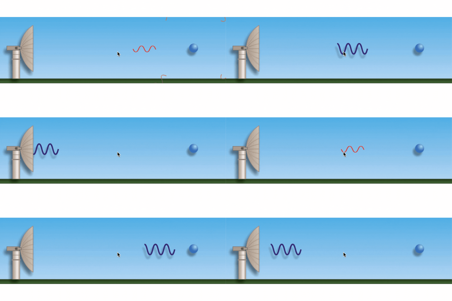
Radars paint pictures of the atmosphere by sending out electromagnetic waves. Think of cell phones. Cell phones send out a wave, and the signal bounces back and forth from the nearest cell tower, and we get our LTE or 4G. Similarly, radars send out signals but, instead of the signal pulse returning once it reaches a cell tower, the radar pulse returns once hitting an object in the air, such as rain, snow, sleet, hail, or even tornadoes. From these return pulses, the radar determines where the precipitation is and how much exists.

Radars that send signals in the horizontal and the vertical paint an even better picture of storms and are called dual-polarization radar, or dual pol. These radars help meteorologists differentiate between the types of precipitation, the amount falling, and how big the precipitation particles are. Radar is one of the fundamental tools of meteorologists.
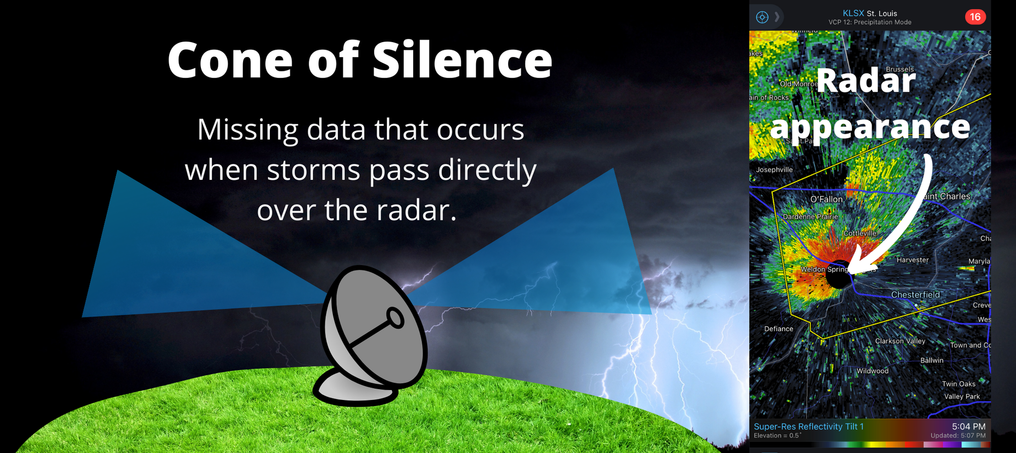
As a radar spins, it will take scans of the atmosphere at different elevations, eventually painting a 360-degree picture around the radar. The radar on your phone will update every 4 to 6 minutes with the latest scan. You may notice on your radar app a gap in the data directly above the radar. That gap is known as the Cone of Silence. Radars have a maximum tilt of 19.5 degrees. When a storm is directly overhead, the radar can’t see it, resulting in a perfect circle on our radar apps (As pictured below). Thankfully, there are over 160 radars around the U.S. which you can click on to get the necessary data and fill in those gaps.

Ok… so now we understand how we get pretty colors… now what do they mean?
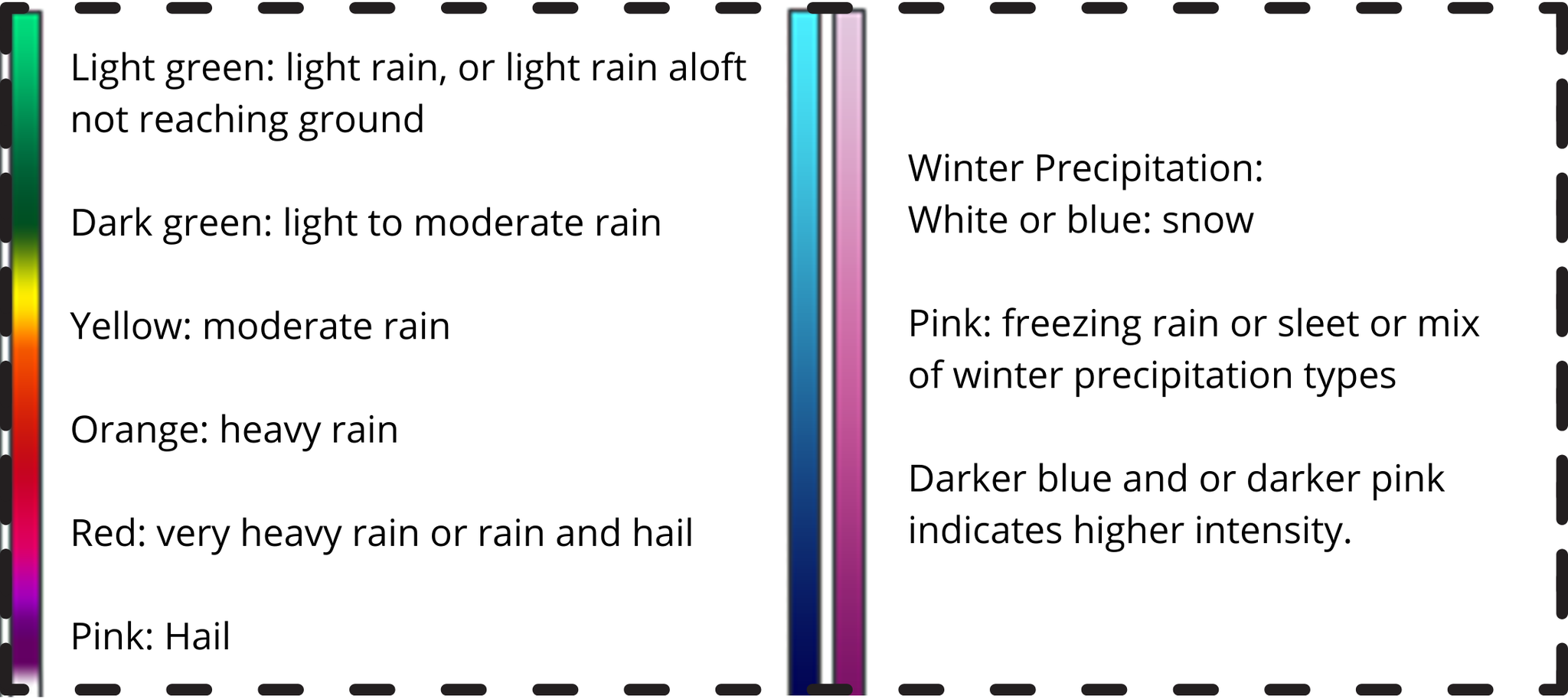
Radar return signals have units of decibels or dBZ. When you hear the phrase “Radar Reflectivity,” that is the return signal (in dBZ) sent back to the radar. High reflectivity indicates higher dBZ returns and correlates to heavy rain or hail. Low reflectivity is from a lower dBZ return and usually means light rain.
These reflectivity values are shown on radar maps as colors. Use the image below as a guide when you are checking out your own radar map. When it comes to light precipitation, either light rain or light snow, the radar has a hard timing picking those particles up, and the app may not show the precipitation. This is when viewer reports and satellite imagery become so necessary in getting the word out.

Let’s look at an example
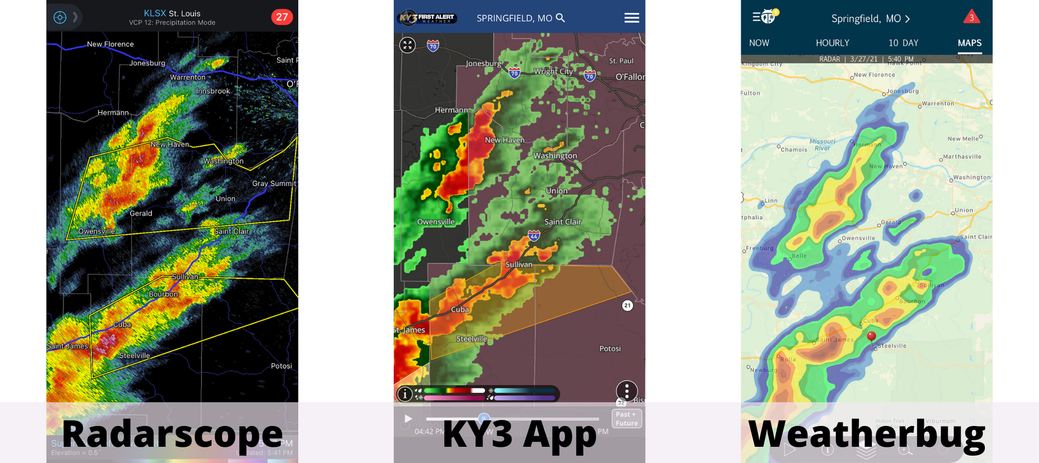
Depending on the radar app you use, the images will differ in their detail and resolution. For example, look below at the comparison between three radar apps of the same severe warned thunderstorms.

The Radarscope weather app is a subscription service. It offers some of the highest radar resolutions with very detailed coloring. Notice the pink colors just northwest of Steelville? What does that mean? Hail of course! If you compare it to the KY3 Weather App, the resolution is a little lower, but even so, notice the darker reds and oranges, which also indicates heavy rain and/or hail.
The last app on the right is your regular iPhone app, Weatherbug. Just a personal note, I have a problem with this app because you cannot overlay warnings onto the radar imagery. Secondly, the resolution is low. You could hardly tell where the hail is located based on this imagery. You miss some of the details of where the heavier rain bands are located.
What is my go-to weather map? If you have Weatherbug on your phone, I’d tell you to delete it right away. While Radarscope is my personal favorite, the KY3 Weather app is a very close second option, especially for the novice radar user. Plus, you can view futurecast radar on it, something that the Radarscope app doesn’t offer.
Storm movement is just as important as understanding the intensity of storms on the radar. How can you tell where storms are moving? Most radar apps have an option to view them in motion, showing their previous movement from the past couple of minutes. By putting the radar in motion and seeing where they come from, you can mentally trace in that direction to see where the storm is heading.
For example, if storms are coming from the southwest, they will generally have an east/northeast movement. Some radar apps offer storm-track overlays. Keep in mind, storms do not always move in a straight line, they wobble about and turn due to upper-level winds. So while drawing a straight line for the storm's direction gives you an estimate of where they're moving to, it is not an exact track. Pay attention to how the track changes with each radar update (Remember, they update every 4 to 6 minutes).
Don't have a weather map? No worries. The National Weather Service has its full network of radars available which you can explore by clicking HERE.
COMING SOON...
Don't forget to check back next week! I'll cover how supercells and thunderstorms look on radars. You will learn how to identify thunderstorm features such as outflow boundaries and recognize where the heaviest rain bands are located. I'll also teach you some more expert radar reading skills, like identifying rotation and tornado debris. Mark your calendar for next Tuesday for the post.

0 Comments Add a Comment?